Old Sussex Mapped
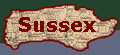
Bowen's Sussex 1756
Contents
![]()
![]()
The work in which this series of maps appeared was published by William Owen, a distinguished publisher and bookseller, who was active from 1748 until his death in 1793. He was a Master of the Stationers Company in 1781. He published a number of political pamphlets.
Benjamin Martin (1704/5-82), the author of The Natural History of England, or a description of each particular county, started work as a plough-boy in Surrey, and became a teacher at Guildford. A legacy of £500 enabled him to take up writing and he published books on a variety of subjects, inculding globes and the determination of longitude. About 1734 he settled in Chichister, where he kept a school, made optical instruments and compiled Bibiloteca Technologica. In 1740 he set up as an instrument maker in London and retired in 1781, but lacking his control the business quickly declined. He attempted suicide and died in the following year.
Map Title: Sussex divided into its RAPES Containing City Borough & Market Towns, with the principal roads and Distance &c. By Eman. Bowen Geographer to His Majesty. Engraved for the General Magazine of Arts & Sciences for W. Owen at Temple Bar 1756. British Statue Miles 15=37 mm (Ca.). Compass (Ca. Below and right of scale). Rapes (Aa.) Explanation (Ee.). Longitude 10' (2') Latitude 10' (2').
Book Title: The Natural history of England, or, a description
of each particular county… By Benjamin Martin. Vol.
1, London, W. Owen and 'the Author', 1759
This map formed part of "The General Magazine of arts and
sciences, 1755-1765". This map was probably based on an
earlier map by Budgen.
Information about the map, and about Emanuel Bowen, taken from
D. Kingsley's Printed Maps of Sussex, 1575-1900.
This map is part of the Sussex County Record Society collection
and can be found under the call number PM69.